


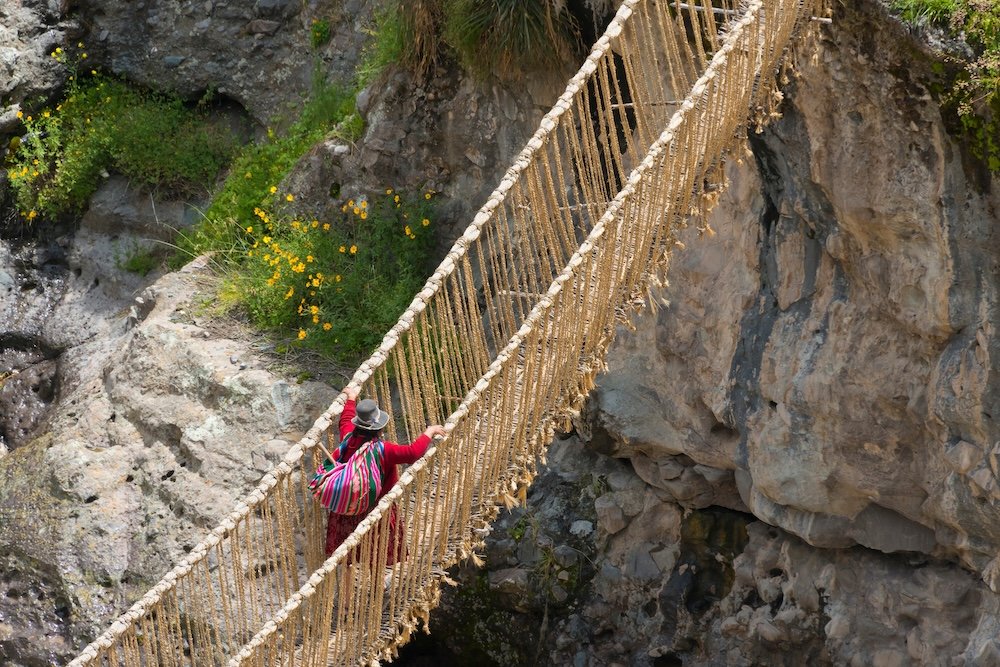
Crushed grass, green and slightly sweet-smelling, is piled higher than the people making the pile. It’s the second week of June on the banks of Peru’s Apurimac River, and four Andean Quechua communities, Choccayhua, Chaupibanda, Huinchiri, and Collana Quehue, have gathered on either side of a canyon to do the one thing they’ve done every year for as long as anyone’s grandparents can remember. Women plait thin cords of ichu grass into thicker ropes. Men take those ropes and twist them into cables as thick as fire hoses. On the second day, teams on either bank winch the cables across the gorge, and by the third, a bridge is back where, for exactly one year, there was only a steel replacement nobody trusted much. Someone crosses first, on hands and knees, to test it. Then everyone else, on foot, because that’s the point.
This is Q’eswachaka, the last handwoven Inca suspension bridge in use, rebuilt from the ground up every June because the grass it’s made from doesn’t last a year in the weather. It’s about 118 feet long across the river, 60 feet high above the water, and sways just enough that first-time crossers tend to grip the handrail cables with both hands and not look down. In 2013, the knowledge and rituals behind its renewal made the Intangible Cultural Heritage list of UNESCO. What the UNESCO dossier doesn’t quite convey is what it feels like to stand on a bridge that is, structurally speaking, older than the printing press and younger than last June.
Q’eswachaka is one crossing on one river. Coincidentally, it sits on the edge of the largest engineering project the pre-Columbian Americas ever undertook: the Qhapaq ñan, the road system that held the Inca empire together and now fragments its way through Peru, Ecuador, Colombia, Bolivia, Chile, and Argentina. In 2014, UNESCO inscribed the network, which it says covers nearly 18,600 miles, though that number carries an asterisk because nobody’s ever been able to map the whole thing. Estimates range as high as 25,000 miles. A quarter of it, by most accounts, is all that’s visible; the rest is paved over, farmed over, or simply eroded back into the mountain.
What the Qhapaq ñan Road Actually Is
Before the Inca, there were the Wari. The Wari gave rise to one of South America’s earliest empires. Their capital city was located near modern-day Ayacucho, Peru, and supported tens of thousands of residents. They connected their territories using an extensive road network. They developed sophisticated terrace agriculture as well as road and canal systems to support their population. What the Inca civilization did in the mid-1400s was less building than annexing and upgrading those earlier routes into a single administrative artery running the length of an empire that, at its largest, stretched from southern Colombia to central Chile.

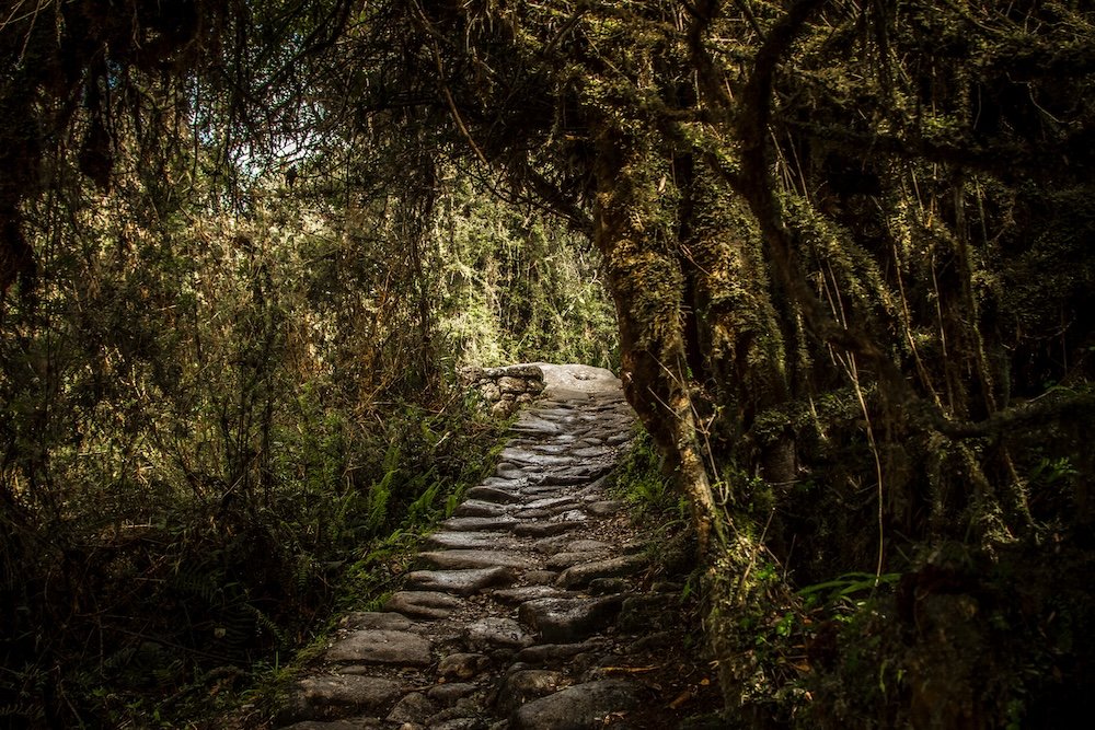
The road varies with altitude. Around Cusco, ceremonial stretches are wide and formally paved, fitted cut stone to within an inch of its life so mortar isn’t necessary. Cross a puna grassland at 15,000 feet, and it tightens up to packed earth and gravel, wide enough for a llama caravan and not much else. Drop down to the coastal desert, and it’s bordered with low stone walls to keep the sand from creeping in to eat it, a problem the Inca solved with labor rather than technology, since they had plenty of the former but not the latter.
The road wasn’t built for travelers. It was built for control: for chasqui runners relaying messages by quipu and word of mouth between relay stations set a mile or two apart, fast enough that word could supposedly make the 500 leagues from Quito to Cusco in under twenty days, and fresh seafood could reportedly make it alive to the Sapa Inca’s table from a coast several hundred miles away. It was built for llama caravans moving maize and textiles between the storehouses that dotted the route. Huánuco Pampa, one of the empire’s provincial capitals, held close to 500 of them. It was built for armies, and for the tambos, waystations spaced a day’s journey apart, that fed and housed all of the above. None of it was built with tourism in mind.

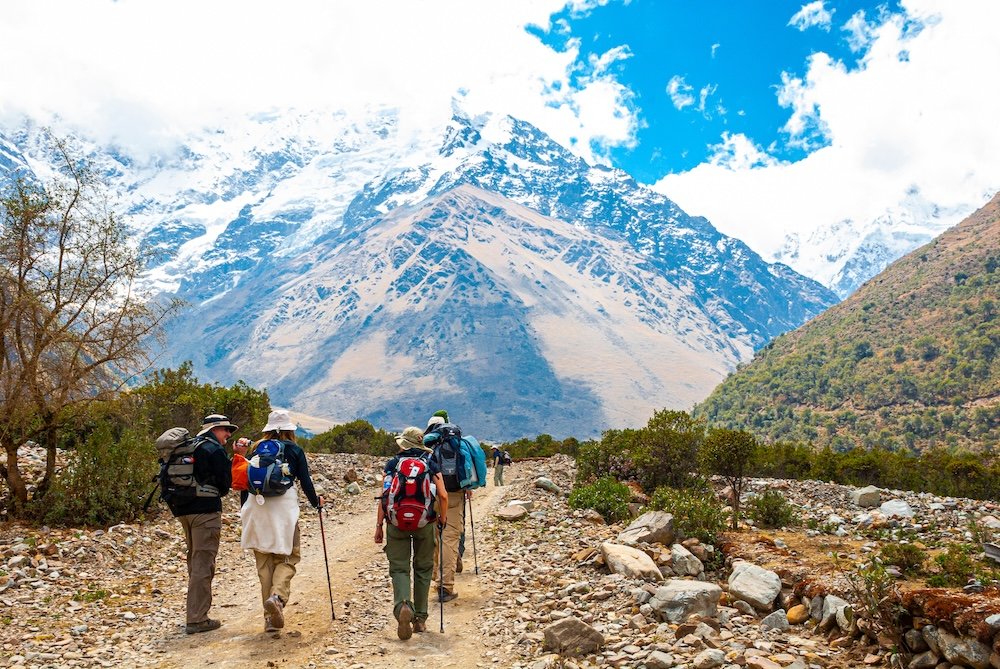
Almost no one hikes the Qhapaq ñan. They hike bits of it, and which bit depends entirely on which country you’ve flown into. Hiking tours along the Qhapaq Ñan range from the classic, heavily traveled Inca Trail to Machu Picchu in Peru to remote, multi-day expeditions in northern Peru and Ecuador. In Peru, that mostly means Machu Picchu, reached via the Classic Inca Trail, the continent’s most tightly regulated four-day hike. Peru’s tourism ministry limits permits to 500 a day between trekkers and support staff combined, which in practice works out to about 200 spots for hikers themselves, booked through licensed operators six to eight months in advance, at a price that ranges from roughly $2,500 to well over $5,000 depending on how much comfort you’re willing to pay for. Guides are required. Porters are as well, and the sight of men in their fifties jogging past exhausted twenty-five-year-old hikers, legally limited to 44 pounds of cargo on their backs but moving like the limit is an insult, tends to recalibrate whatever a visitor thought they knew about fitness.
Those who can’t get a permit, or aren’t interested in the crowds, default to alternatives like the Salkantay trek, unregulated and arguably more scenic, or push further afield to Choquequirao, an Inca site that actually encompasses more ground than Machu Picchu and gets a fraction of the visitors, because reaching it requires a four to five day round trip on foot or mule through the Apurimac canyon. A cable car has been talked about for years as a way to shrink that to twenty minutes. But for now, it is a trek, and Choquequirao remains a place you earn.
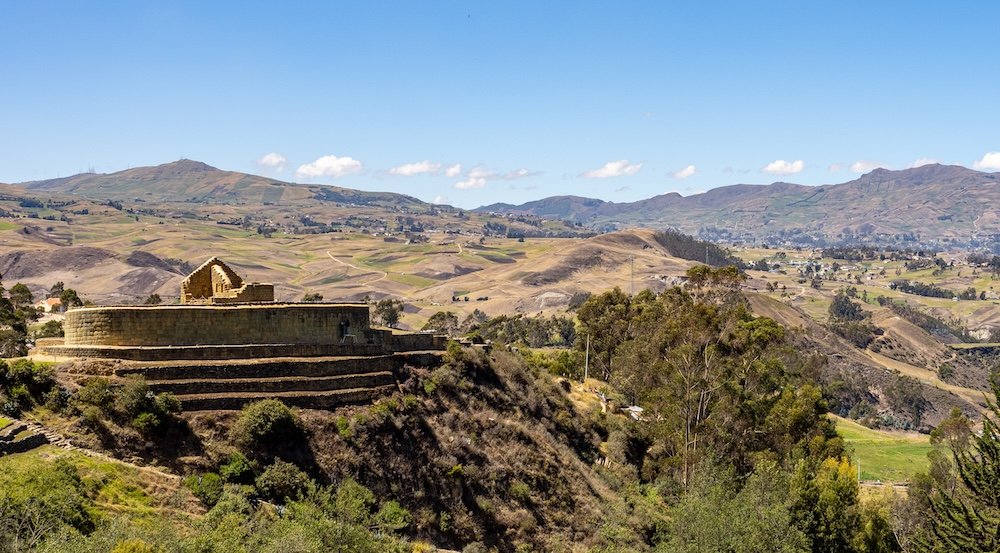
Outside Peru, the road is much quieter and less thought through. In Ecuador, Ingapirca, the country’s largest Inca site, is an hour or so from Cuenca by bus or taxi, easily doable as a day trip, though the serious way in is a three day walk from Achupallas along a surviving section of the original road. In Argentina’s Catamarca province, El Shincal de Quimivil is an Inca provincial capital so architecturally complete it’s half-jokingly called the Argentine Cusco, and it’s literally perched on the road’s old trunk route just outside the town of Londres, reachable by car or short 4×4 ride off Ruta 40, with the actual Inca road cutting straight through what was once its main plaza.
In Bolivia and Chile, it’s long stretches through the altiplano and the Atacama, mostly known to archaeologists and the occasional overlanding traveler with a rented 4×4 and a lot of patience. Colombia’s section, wedged into the department of Nariño around Pasto, has almost no tourism infrastructure, which is its own kind of statement about how unevenly a shared UNESCO listing gets treated once you cross a border.
No single vehicle defines this trip, because there isn’t a single trip. It’s boots and mules on the trekking routes, buses and taxis for the day trip sites, a train for the last leg into Machu Picchu’s valley, and rented 4x4s for the long, empty stretches in Argentina, Bolivia, and Chile where the road exists mostly as a line on an archaeologist’s map.
What Catches People Off Guard
Altitude does most of the ambushing. Cusco is above 11,000 feet before any trail has even taken a step, and the acclimatization spiel is accurate: hydrate, go slowly, spend a couple of days at altitude first. The rules get skipped just often enough that guides carry oxygen as a matter of course, not precaution.
The other surprise is subtler: how often the road is still in use for what it was built for. Around Ingapirca and through the Sacred Valley it’s common to pass a farmer walking the same cobbled path a chasqui once ran, herding sheep or carrying firewood, entirely unconcerned by the hikers photographing the stones under his feet. The Qhapaq ñan reads, in guidebooks, like a monument. On the ground, in a lot of places, it’s just the shortest way to the next village, still doing the job it was built for five centuries after the empire that built it stopped existing.

Back at Q’eswachaka, the old steel bridge looms maybe a hundred meters downstream, load-bearing, permanent, and largely ignored. Locals cross the new grass one instead, as they have every June for longer than the steel bridge has existed. It’ll start fraying by next spring. Nobody seems concerned by that. There’s already a plan for June.