


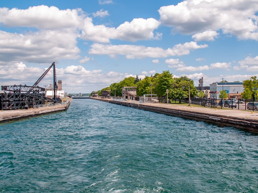
The water drops fast at the Soo Locks, faster than most passengers expect the first time they feel it. A deckhand on the lower deck ties off against the wall of the MacArthur Lock in Sault Ste. Marie, Michigan, and within about twenty minutes the ship settles twenty-one feet, the concrete walls rising around the hull like a bathtub draining in slow motion. Then the lower gates open, and Lake Superior, the largest freshwater lake on Earth by surface area, is behind you, and Lake Huron is somewhere ahead through the St. Marys River. Twenty-one feet doesn’t sound like much until you’ve watched it happen from a deck chair with a drink in your hand, and it’s worth remembering that the entire reason this maneuver exists, the entire reason there’s a lock here at all, is that the lakes weren’t built level.
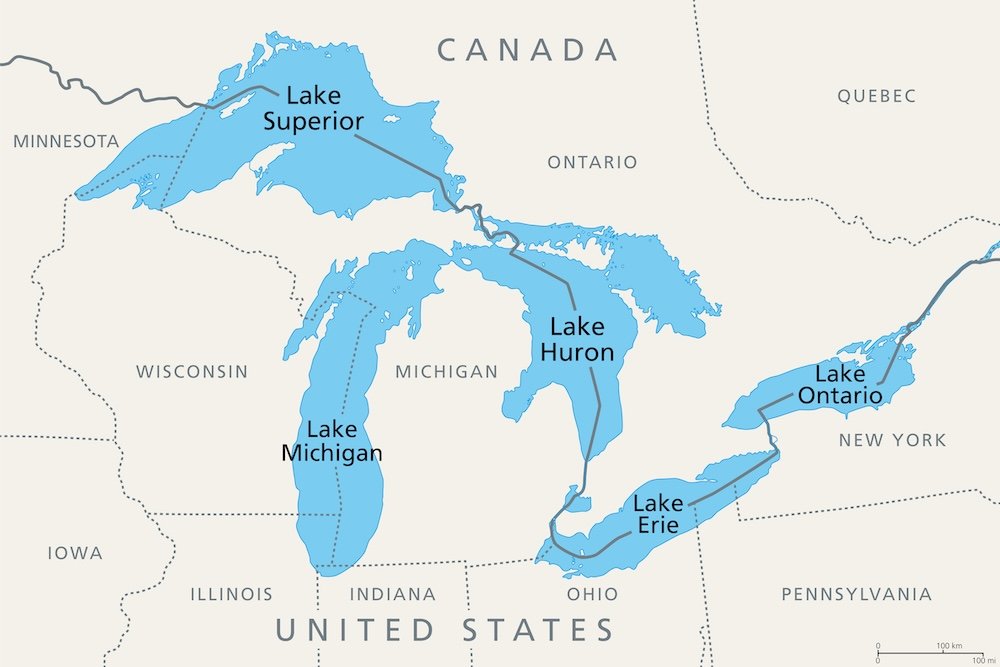
Nothing about them was built on purpose. Superior’s basin traces back to the Midcontinent Rift, a 1.1-billion-year-old attempt by the North American continent to split itself in two that ultimately failed, leaving behind weakened rock that erosion would later exploit. Farther south and east, shallow seas advanced and retreated across the Michigan Basin roughly thirty times between 500 and 300 million years ago, stacking more than 14,000 feet of sediment into a bowl shape that still shows up on elevation maps today. None of that produced open water. That took ice: the Laurentide Ice Sheet, which began building 2.6 million years ago and reached its final, heaviest advance between 25,000 and 21,000 years ago, burying the region under ice sheets 3,000 to 9,000 feet thick. As that mass ground south and then retreated north again around 20,000 years ago, it scoured out the softer rock the ancient rift and the old seabeds had already weakened, and the meltwater that followed had nowhere to go but into the trenches the glacier had carved. For a while, the water that would become five separate lakes was one much larger lake, Lake Algonquin, before the land itself, released from the weight of all that ice, rose back up unevenly and tilted the outlets until the five basins we’d recognize today settled into place. Geologically, the Great Lakes are barely finished. The ground under them is still rising.
The numbers, once you get to them, are almost too large to hold onto. The five lakes together hold roughly six quadrillion gallons of water and cover about 94,000 square miles, spanning more than 750 miles from Duluth to the eastern edge of Lake Ontario. That’s 21 percent of the world’s surface fresh water and 84 percent of North America’s, all sitting within a single basin that’s home to more than 30 million people: about 10 percent of the U.S. population and over 30 percent of Canada’s. Superior alone is the largest of the five by both area and volume, deep enough at its maximum point (1,332 feet) to swallow the Empire State Building’s roofline whole, with only the antenna left poking above the surface. Lake Michigan is the only one of the five entirely within the United States; the other four straddle the international border, which is why a ship can leave a Canadian port and clear customs in a U.S. one without ever really feeling like it’s crossed an ocean.
All of that water has always meant work. The Great Lakes-St. Lawrence Seaway system moves iron ore, grain, coal, steel, cement, and petroleum products through more than 110 ports across eight U.S. states and two Canadian provinces, generating an estimated $50 billion in economic activity and supporting well over 350,000 jobs on both sides of the border. Zoom out further and the entire Great Lakes region produces more than $6 trillion in combined economic output, enough that if it were counted as its own country, it would rank among the largest economies on Earth. Basin farmland accounts for roughly a quarter of Canada’s agricultural production and 7 percent of America’s. Underneath all of it, quietly, the lakes supply drinking water to tens of millions of people.
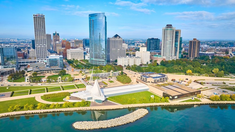
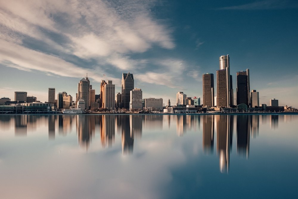
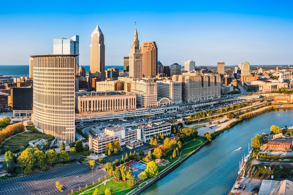
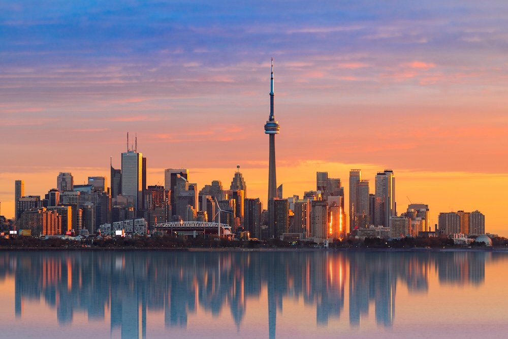
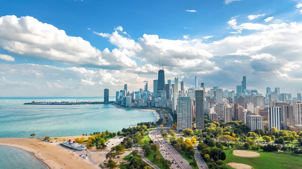
All that industry needed cities to run it, and the lakes grew some of the largest ones in North America almost overnight by nineteenth-century standards. Chicago went from a trading post to the country’s third-largest city on the strength of grain elevators and rail yards feeding off Lake Michigan traffic. Toronto did the same thing on Lake Ontario’s north shore and is now, within city limits, the largest city on any of the five lakes, narrowly ahead of Chicago. Detroit grew up on the strait connecting Erie to Huron rather than on a lake shoreline itself, a location convenient enough for shipping that the city eventually started building the cars that would later replace the boats, while Cleveland, Milwaukee, and Buffalo each followed a version of the same formula: a natural harbor, a rail line, and a waterfront factory district that spread inland from there.
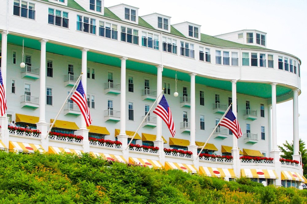
Not every lakeside town went industrial. Mackinac Island, in the strait between Michigan and Huron, banned automobiles in 1898 after the first “horseless carriage” to arrive by ferry spooked the horses that ran the island’s carriage trade, and the ban simply never lifted. The island still gets around by bicycle and horse-drawn carriage, still perfumes its downtown with the smell of fudge being made in shopfront windows, and still books guests into the Grand Hotel, whose 660-foot porch is generally credited as the longest in the world. The other well-known getaways run smaller and less formal: Door County, Wisconsin, strings fishing villages and orchard towns up a narrow peninsula into Lake Michigan; Traverse City has built a hundred-year-old festival around the cherry trees planted on its hillsides in the 1850s; Put-in-Bay, on Lake Erie’s South Bass Island, draws a rowdy summer ferry crowd locals call the Key West of Lake Erie; and the sandstone sea caves and lighthouses of Wisconsin’s Apostle Islands, out on Superior, pull the same kind of crowd with considerably less noise.
Which brings the story back around to that lock in Sault Ste. Marie, because the ship dropping through it represents an industry that, by most measures, shouldn’t exist anymore. More than thirty passenger lines operated on the upper lakes at their peak in the early twentieth century, and by 1970 the market had collapsed entirely, killed off by interstate highways, regional airlines, and an 1886 federal law restricting foreign-built ships from carrying passengers between U.S. ports. For decades, nobody could make the economics work. The revival started small in 2015 with the Pearl Mist, a 210-passenger ship that got around the old passenger-vessel restrictions by structuring itineraries to include Canadian ports, and it picked up real momentum when Viking entered the market in 2022 with the purpose-built expedition ships Octantis and Polaris, each carrying 378 guests to ports most large cruise ships have never approached. Port visits hit a record near 150,000 in 2022 and were projected around 170,000 the following year, generating an estimated $180 million annually for the region, and states from Wisconsin to Minnesota have been pouring money into cruise terminals, betting the trend holds. It has: Pearl Seas is running four separate Great Lakes itineraries in 2026, up to fifteen nights and covering all five lakes, with several sailings already sold out months ahead of the season. Viking’s 2026 offerings run from an eight-day Niagara-to-Milwaukee route up to a fifteen-day full loop from Toronto to Duluth.
None of those passengers are discovering anything. People have been living on, fighting over, mining, fishing, and occasionally going down with the ship in these lakes for something like ten thousand years, and the water itself has only existed in its current shape for a fraction of the planet’s history, still rising in places where the last glacier’s weight hasn’t quite let go. What’s actually new is who’s allowed on board, and the fact that after fifty years of empty water where the passenger ships used to be, someone in a hard hat at the Soo Locks is once again radioing ahead that a ship full of tourists is coming through, twenty-one feet at a time.