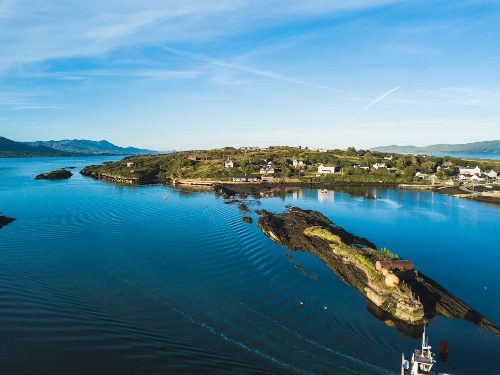
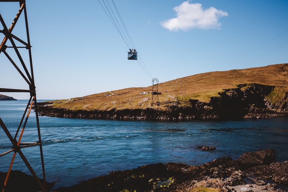
At the western end of Ireland’s Beara Peninsula, a sturdy cable car extends out over Dursey Sound on a cable about 1,230 feet long and takes six passengers across one of the most powerful tidal races on the Irish coast. The journey lasts seven and a half minutes. Cork County Council launched the service in December 1969 so people on the island could reach the mainland in bad weather. Until 2012 it also carried livestock, which means that for over four decades a tourist could reasonably have shared the ride with a sheep. It is still Ireland’s only cable car and the only one in Europe which crosses open seawater. On the other side there is an island four miles long with three permanent inhabitants, no shop and no pub. Most visitors go to the old signal tower and the wartime ÉIRE sign, carved into the stone so pilots flying past would know they were over neutral territory.
Dursey Island, Beara Peninsula, Ireland
Why Beara
The peninsula spans both Cork and Kerry and runs between Bantry Bay and the Kenmare River. The well-known Ring of Kerry attracts the tour coaches, while Beara has narrower roads that tend to keep them away. The Ring of Beara route is about 92 miles long and can be done in half a day, but the honest advice is to spend two or three nights in Glengarriff, Castletownbere, or Allihies, and allow time to stop wherever a sheep or a view suggests.
Beara Peninsula road
Beara provides an extremely genuine experience of Ireland. The region almost demands slow travel, and it offers plenty of fascinating points of interest for visitors to explore. It has Bronze Age stone circles, famine roads, Victorian gardens, a functioning fishing port, and a mining area that sent workers to Montana, and the area still feels inhabited rather than merely staged. The drawback is that the mobile signal weakens between the villages, and the roads require patience rather than strict adherence to timetables.
The Road and its Detours
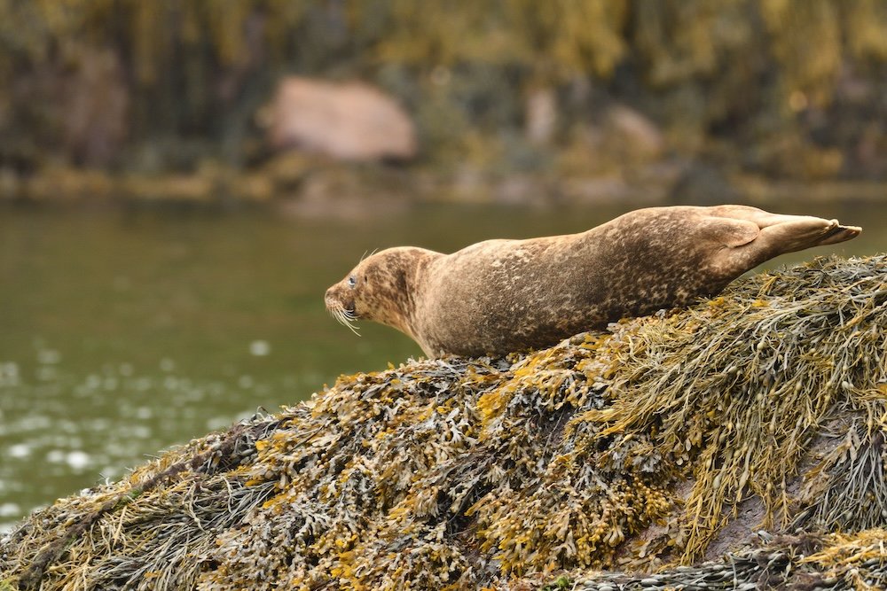
Starting at Glengarriff, the mild southeastern entrance, ferries go to Ilnacullin or Garinish Island, stopping near some rocks where harbor seals lie around like local favorites who have seen every camera ever built. The British built the Martello tower on the island around 1815 in response to the French fleet’s 1796 attempt to land in Bantry Bay. By 1910, the War Office had decided the French would not be returning and sold the island to Annan Bryce, who had Harold Peto transform the bare rock into an Italianate garden.
Harbor Seal (Phoca vitulina), Glengarriff, Ireland
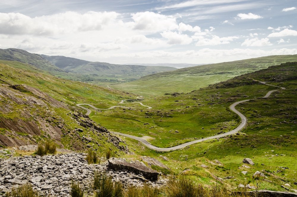
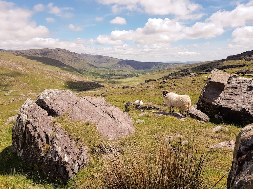
Halfway down the south coast, Healy Pass rises up the Caha Mountains towards Lauragh in Kerry. It was originally built in 1847 as a famine-relief road, providing paid work for starving people along an old track known as Bealach Scairte, the path of the sheltered caves. The road later took the name Tim Healy, the politician born in Bantry who became the first Governor-General of the Irish Free State and died in 1931, shortly after the road was improved. The summit sits at about 1,000 feet and is reached by a series of hairpins that, for a moment, turn every driver into a rally enthusiast. Hungry Hill, the highest peak in the Caha range, lies to the west and gave its name to Daphne du Maurier’s 1943 novel.
Healy Pass
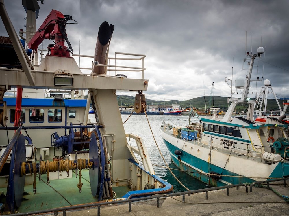
Castletownbere is the town by which the peninsula carries out its activities. It is Ireland’s biggest port for whitefish, and in the pubs people talk about quotas and the weather rather than the views. MacCarthy’s Bar, in business since 1860, still has a grocery section at the front and a bar at the back, and it appeared on the cover of Pete McCarthy’s 2000 bestseller McCarthy’s Bar. The family’s own history is in fact greater than the book: Aidan MacCarthy, the father of the sisters who run the bar, survived being at Dunkirk, being on a ship that was torpedoed, and the atomic bombing of Nagasaki as a prisoner of war.
Fishing boats at the port of Castletownbere
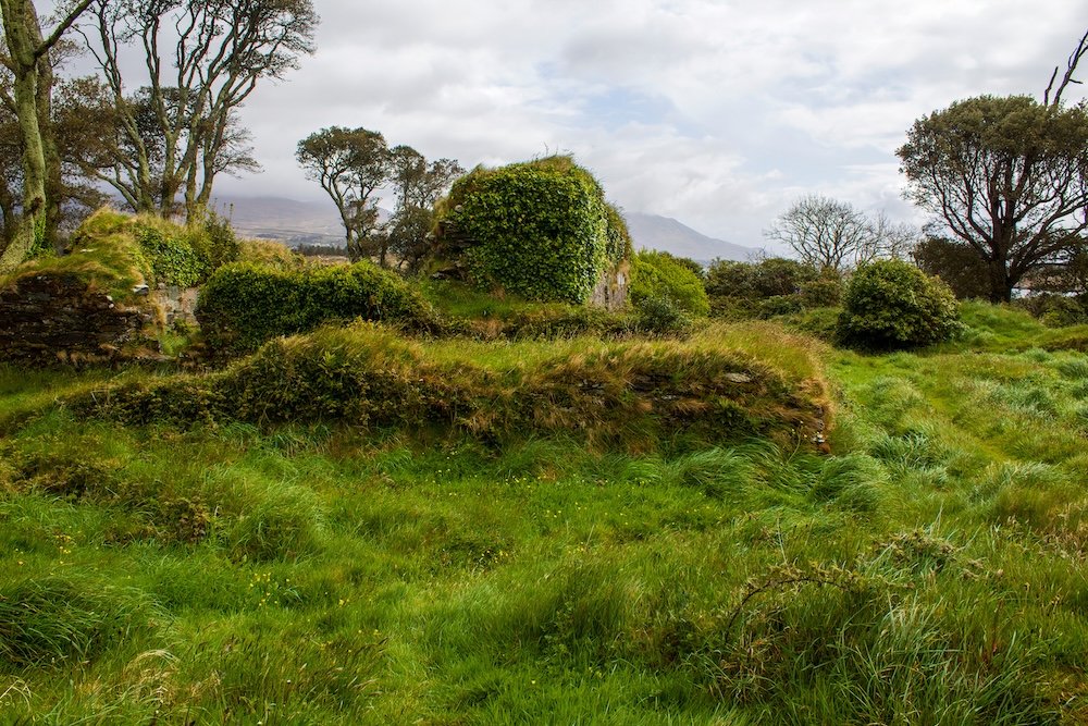
Beyond the town, the ruins of Dunboy Castle can be seen, and these ruins are central to the peninsula’s most notable story. After their defeat by the Irish and the Spanish at Kinsale, English forces under Sir George Carew laid siege to Dunboy in June 1602, captured the castle after eleven days, and hanged the remaining defenders. The clan chieftain, Donal Cam O’Sullivan Beare, was not at the castle at the time, and that year he continued to fight a guerrilla war he could not win. On New Year’s Eve he led 1,000 of his people north on foot in the middle of winter. At the River Shannon, with their enemies approaching, they spent two days building a boat of hide stretched over hazel rods, then crossed in the dark, twenty-eight at a time. Only 35 of them reached O’Rourke’s castle in Leitrim about two weeks later. Donal Cam died in exile in Madrid in 1618 and had never seen Beara again; his route is now accessible by walking the Beara-Breifne Way.
All that remains from Dunboy Castle near Castletownbere in County Cork
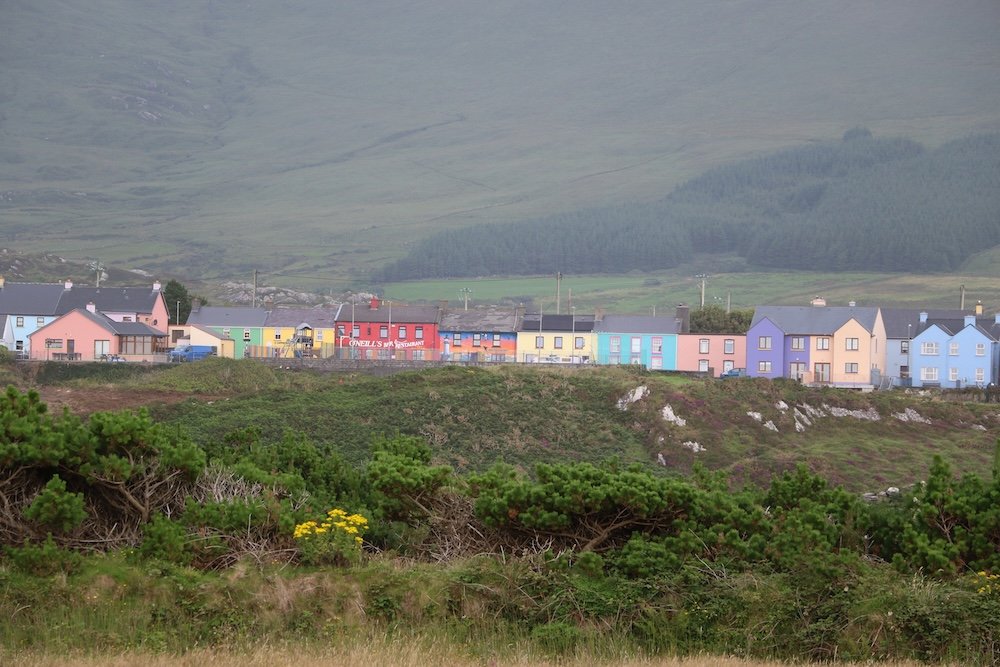
Beyond Castletownbere, the road narrows toward Allihies, where copper has been mined since the Bronze Age. The industrial era began in 1812 under John Puxley, whose family inspired du Maurier’s novel, and at their peak the mines employed some 1,500 people. Cornish engineers arrived to sink the shafts, and their roofless engine houses still stand on the hillsides like chess pieces left mid-game. The most remarkable of them housed the Man Engine, a steam-driven contraption of moving platforms that lowered miners into the shafts, the only one ever installed in Ireland. The Allihies Copper Mine Museum, set in a former Methodist church, tells the story plainly, down to the miners who emigrated to Butte, Montana, where Allihies surnames remain common.
Village of Allihies
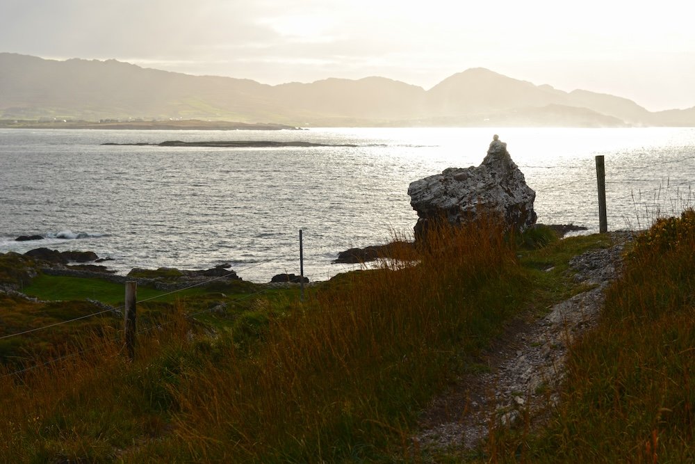
The north shore is even quieter. Beyond the painted houses of Eyeries, on a piece of land near Kilcatherine, stands the Hag of Beara, a pale boulder believed to be the petrified Cailleach Bhéarra, the ancient goddess of winter, turned to stone as she watched the sea. People leave various offerings in her cracks: mostly coins and shells, although it has also been noted that hair ties, clothespins, and at least one car remote control have been left. Nearby is the Ballycrovane Ogham Stone, 17 feet tall and considered Ireland’s tallest ogham stone.
Hag of Beara, a pale boulder believed to be the petrified head of Cailleach Bhéarra
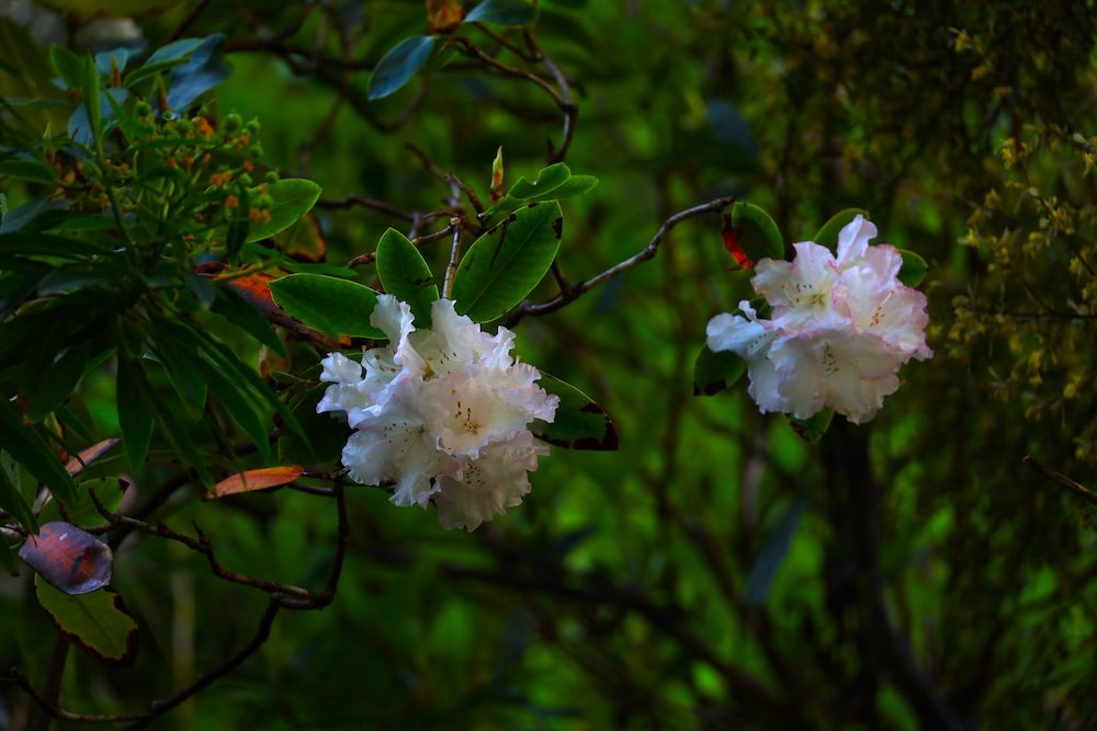
At Lauragh, Derreen Garden covers 60 acres of woodland planted by the fifth Marquess of Lansdowne starting in 1870, and is well known for its groves of Australian tree ferns and large rhododendrons. Children are encouraged to look for the small houses of the Derreenies, beings rarer than fairies and whose last known sighting, according to the garden records, was in 1855.
White flowers in Derreen Garden
Near Allihies, the Dzogchen Beara Buddhist retreat center sits on a clifftop and offers drop-in visitors a chance to visit its café, which may serve the most peaceful cup of tea on the Wild Atlantic Way.
What Visitors Do
Most visitors start with the Ring of Beara drive, which takes half a day without stops. Everybody stops along the way. The people who stay longer spend most of their time out of the car.
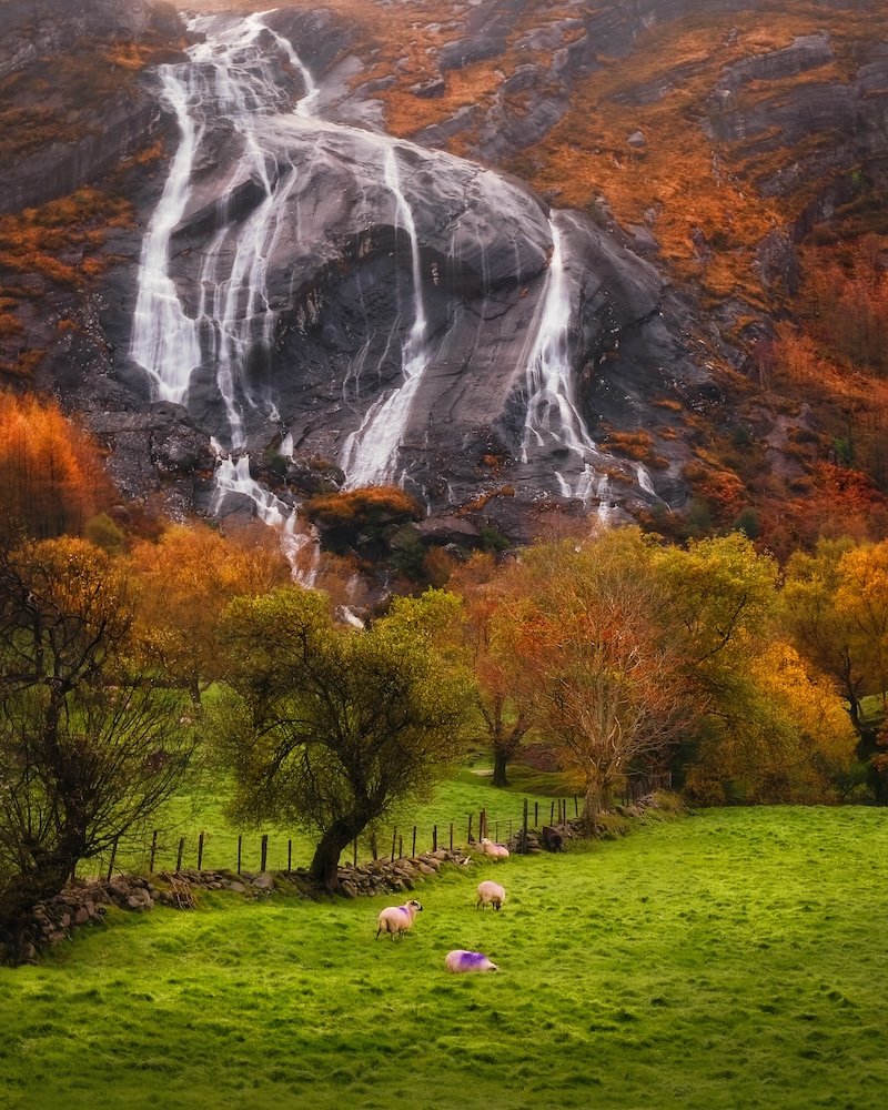
Walking is the reason many come. The Beara Way, a waymarked trail of about 128 miles, circles the peninsula from Glengarriff in roughly nine days, and walkers who don’t want to commit to the whole thing do single sections. For a shorter outing, Gleninchaquin Park, a working farm in a glacial valley on the Kerry side, has marked walks from 40 minutes to a full day. They pass lakes, old oak woods, and a waterfall that comes down the valley head. Admission is €7 (about $8), cash only, and the park usually closes from November through February.
Spectacular Gleninchaquin waterfall in autumn
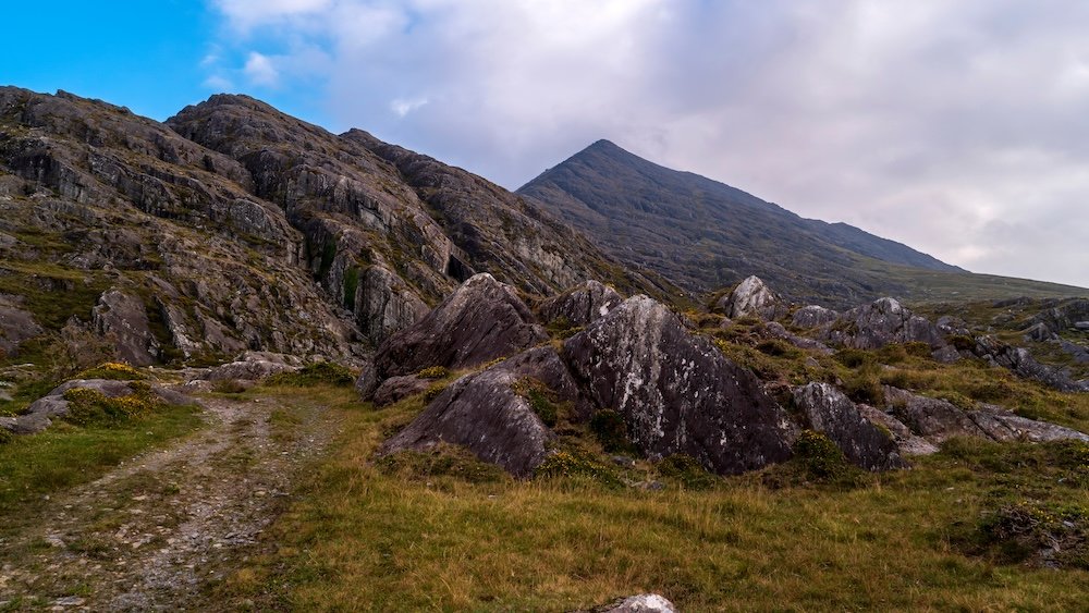
Hungry Hill, the highest peak in the Caha range at 2,247 feet, is the serious climb. Above Adrigole, the lakes on its slopes drain into the Mare’s Tail, a waterfall often called the tallest in Ireland and Britain, and after heavy rain it is easy to believe. Back in Glengarriff, the nature reserve holds some of the oldest oak and birch groves left in Ireland, and a short, steep path climbs to Lady Bantry’s Lookout above the harbor.
Looking towards the peak of Hungry Hill in the Caha Mountains.I
On the water, Beara rewards anyone with a light jacket and a steady stomach. From April through September, Dursey Boat Trips sails from Garnish Pier for a 90-minute run past Dursey to the Bull Rock, a sea stack with a tunnel straight through it, a lighthouse on top and a large gannet colony. Irish myth calls it Tech Duinn, the house of Donn, where the souls of the dead gather before setting out westward. The trip costs about €64 (roughly $75), and dolphins, seals and the occasional whale tend to show up along the way. Guided kayaking runs on Glengarriff’s sheltered bay, and sea-angling charters and dive operators work out of Castletownbere.
Bere Island is a fifteen-minute ferry ride from Castletownbere. The island is about six miles long and has a long military past. Britain held Berehaven as one of its Irish “Treaty Ports” until 1938, and the gun emplacements of Lonehort Battery, begun in 1899, still sit among the gorse. Martello towers, a Bronze Age wedge tomb, a heritage center in the old schoolhouse and a couple of pubs fill out a slow day.
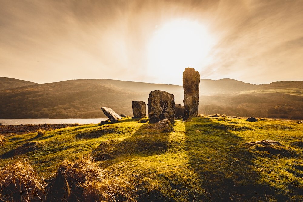
Ancient sites are everywhere, and nearly all are free. The Uragh Stone Circle stands on a knoll between two lakes above Lauragh. It is a ring of five stones, the tallest about 10 feet high, with a waterfall behind it that looks set there for the photograph.
Uragh Stone Circle, Gleninchaquin Park
The slower pleasures count too. At Allihies, Ballydonegan Beach is made of crushed quartz left over from the copper mines, which is why the sand brushes off so easily. The village’s Copper Mine Trail loops past the old engine houses on walks from one to six miles. Golfers play Berehaven, a nine-hole course near Castletownbere where water comes into play on every hole and the views across Bantry Bay make up for most bogeys. Evenings end in the pub. In Allihies, the Lighthouse Bar has music out back on weekend nights.
The Culture
Culture in Beara is based on work: fishing boats and sheep farms set the pace, and tourism is arranged to suit them. The best example is Castletownbere’s Festival of the Sea, which takes place every year during the week containing the August bank holiday. The festival’s program has long included net-mending and sea-angling competitions alongside gig racing, set dancing, and a best-dressed-dog competition, all of which reveal much about local priorities. Allihies has traditionally held its own festival on August 15, featuring horse racing that probably goes back to the ponies used in the mining period.
What to eat and drink
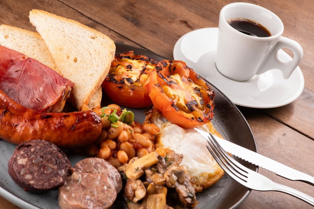
Beara eats like a working coast, and the day usually starts with a full Irish breakfast: fried or scrambled eggs, bacon (rashers), sausages, baked beans, grilled tomato and mushrooms, with toast or brown soda bread on the side. Many plates also come with black and white pudding, two sausage-like slices. The black one is made with blood and the white one isn’t, and nobody minds if a guest leaves both for the sheepdog.
An Irish Breakfast
Lunch and dinner are pub food. Seafood chowder with buttered brown bread and an open crab sandwich are the local standards, and MacCarthy’s Bar in Castletownbere has been doing both for years, using fish landed a short walk from the bar. Beyond that, mussels, fish and chips, and lamb from the hillsides the Ring of Beara road passes through turn up on most menus. Near Eyeries, the Steele family has made Milleens since 1976. It’s a soft, washed-rind cheese and one of the first farmhouse cheeses of Ireland’s modern revival, and it makes the best picnic on the peninsula.
In the evening, drinkers will find Murphy’s, the Cork stout, alongside the Guinness. Anyone who doesn’t drink alcohol is just as welcome at the bar: pubs serve Guinness 0.0, soft drinks and red lemonade, and pots of strong Barry’s tea, Cork’s own blend. Nobody on Beara expects a guest to order a pint to sit by the fire and listen to the music.
When to Go
The high season runs from late June to August, when temperatures reach the lower to mid-60s Fahrenheit, evenings in June are dark after 10 p.m., and festivals are at their busiest. During this time, long queues form for the six-person Dursey cable car, and fewer beds are available in the smaller villages.
The shoulder seasons, that is, the period from April to May and from September to October, are ideal. In May the weather is generally the sunniest and one of the driest; both Ilnacullin and Bantry House are open, and Derreen’s rhododendrons are in their prime. In September the sea is still close to its annual peak of around 60 degrees, the number of summer visitors has decreased, and the light is long and golden.
From November to March, the low season is wet, windy, and dark by late afternoon, with temperatures hovering around 50 degrees; the region averages about 60 inches of rainfall, with December the wettest month. Many gardens and ferries stop operating, and the cable car runs reduced hours. Yet the pubs remain open, the fleet continues to work, and a visitor in January has the Healy Pass almost to themselves.
The cable car is still swaying over the sound and the Hag is still turning its face towards the sea, waiting for whatever the tide sends its way and very likely a few more coins.