


At Mountain Crossings, the outfitter built into the trail itself at Neel Gap, Georgia, there’s a rhododendron tree strung with boots. Thru-hikers who quit within the first thirty miles — and a startling number do, somewhere around fifteen to twenty percent by most counts kept at the shop — sometimes leave their footwear behind as a kind of offering, or a warning, depending on how you read it. I watched a man in his fifties sit on the outfitter’s porch one April morning, peel off socks that had gone the color of the trail itself, and explain to nobody in particular that he’d underestimated Blood Mountain by roughly everything. His pack was still shipped-from-REI clean. The trail had been open to him for four days.
This is the thing about the Appalachian Trail that gets lost in the mythology of the 2,197-mile thru-hike: most people who touch it never intend to walk the whole thing, and the trail does not seem to mind. It crosses a paved road every four miles on average, which means almost any stretch worth seeing is also one you can sample on a Tuesday and be back at your car or a diner by dark. What follows are seven such stretches, arranged roughly from south to north, each a full day’s walk and none requiring a permit, a resupply box, or a conversation about trail names.
Blood Mountain, Georgia
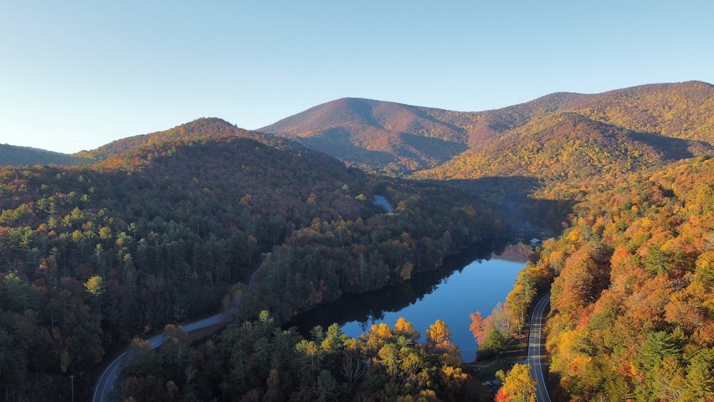
The 4.3-mile round trip from the Byron Reece trailhead at Neel Gap climbs about 1,400 feet to Georgia’s highest point on the AT, and it front-loads its punishment, you gain over 400 feet in the first three-quarters of a mile, which is why that man on the porch looked the way he did. The summit holds a stone shelter built by the Civilian Conservation Corps in the 1930s, low-ceilinged and drafty, the kind of structure that makes you grateful for Gore-Tex and slightly ashamed of it too, given what the men who built it wore. Go in April, and you’ll share the trail with a fresh crop of thru-hikers still walking with the stiff optimism of people who haven’t yet done the math on Maine. Go in October, and the summit clears of leaves entirely, exposing three hundred and sixty degrees of ridgeline in every direction, no permit required, no bootprint offering necessary.
McAfee Knob, Virginia
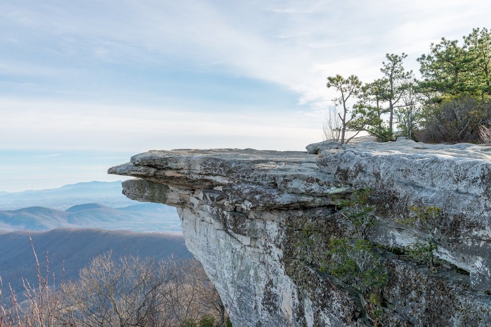
McAfee Knob has become, somewhat against its will, the single most photographed spot on the entire Appalachian Trail — that flat sandstone ledge jutting into open air above the Catawba Valley, the one that shows up on calendars and Instagram grids with a lone hiker’s silhouette dangling boots over the edge for a photo that has by now been taken, conservatively, several hundred thousand times. The loop from the Virginia 311 trailhead runs 7.7 miles with about 1,170 feet of elevation gain, rated moderate on paper and felt considerably more so by most people who hike it in August humidity. The Roanoke Appalachian Trail Club, which maintains this section, has spent years fighting a losing battle against overcrowding, illegal camping, and the general wear of a landmark that photographs better than it holds up under foot traffic. Go at first light on a weekday if you want the ledge to yourself for even five minutes. Otherwise you’ll be waiting in a small, oddly polite line of strangers taking turns dangling their own boots over the same drop.
Dragon’s Tooth, Virginia
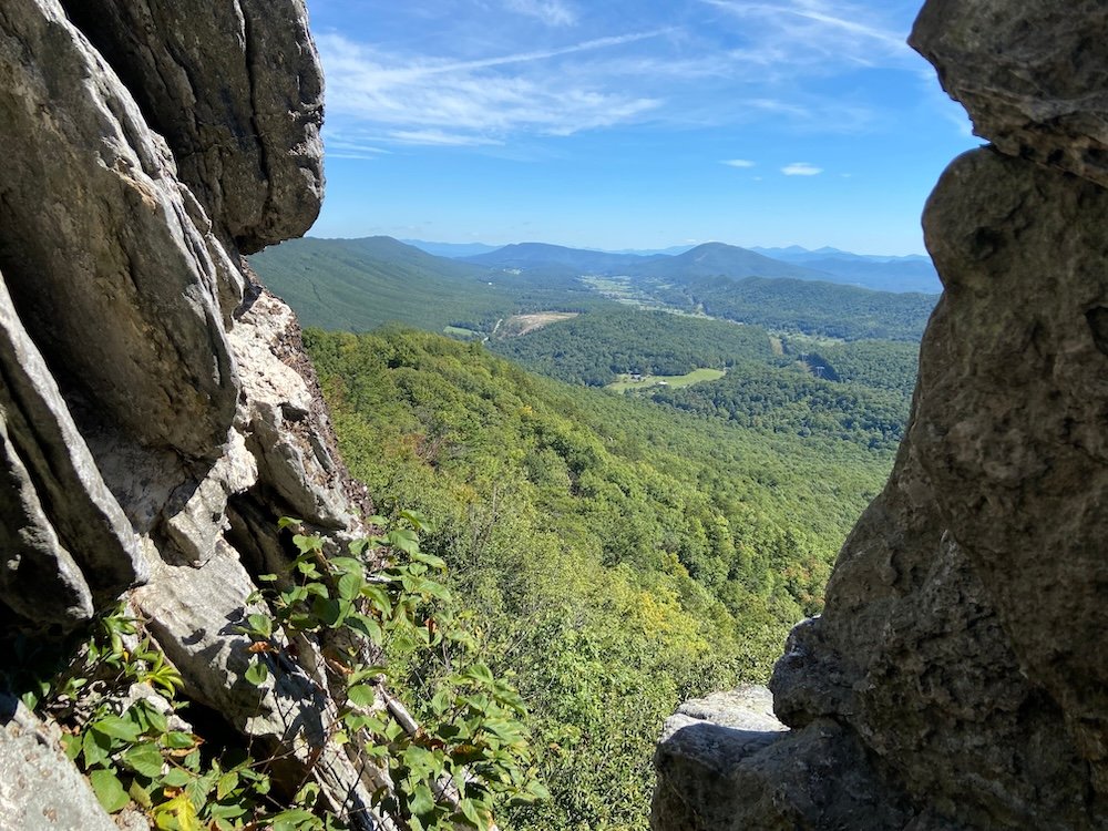
Twenty minutes down the road from McAfee Knob, Dragon’s Tooth gets a fraction of the visitors and none of the calendar photography, mostly because the last half-mile requires actual scrambling — hands, feet, occasionally a moment of quiet negotiation with a rock face — up to a thirty-five-foot spire of tilted sedimentary stone that looks, from certain angles, like something that should not have occurred naturally. The 4.8-mile out-and-back gains 1,309 feet and takes most hikers three to four hours, longer if the scrambling humbles you the way it’s designed to. Dogs are discouraged here for good reason; I watched someone’s border collie attempt the final pitch and immediately reconsider its life choices. Along with McAfee Knob and Tinker Cliffs, this makes up Virginia’s so-called Triple Crown, three summits close enough together that ambitious hikers sometimes string all three into one long day. I’d argue against it. Dragon’s Tooth deserves to be walked slowly enough to notice you’re climbing a piece of the Cambrian seafloor tilted ninety degrees into the sky.
Charlies Bunion, Great Smoky Mountains
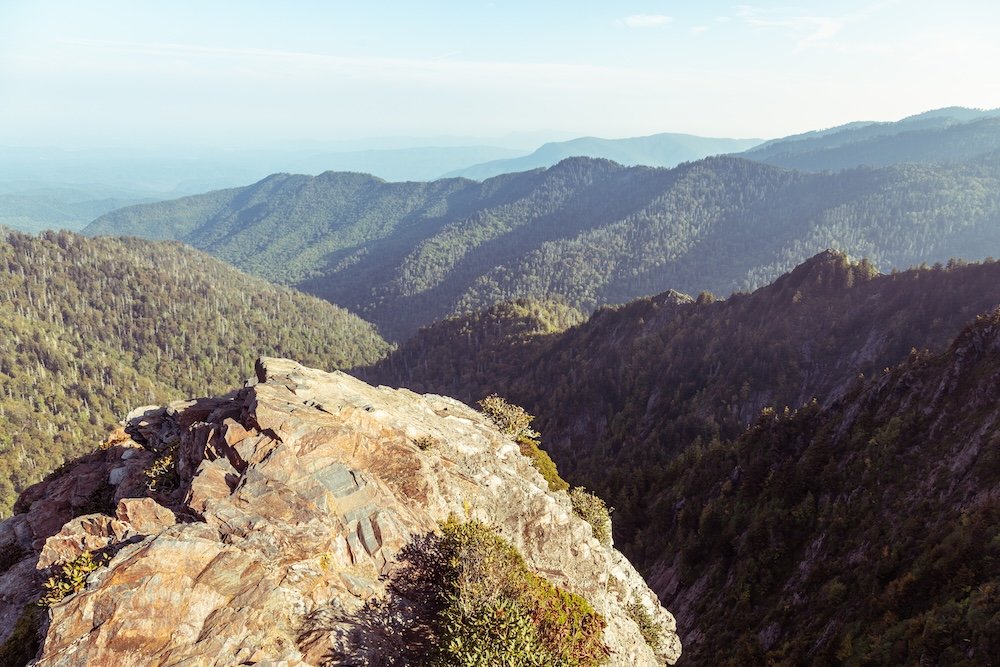
Named, according to trail lore that’s stuck for a century, after a hiker named Charlie Conner whose bunion reminded early park advocate Horace Kephart of the rocky outcrop itself, an origin story so unglamorous it has to be true. The 8.1-mile round trip from Newfound Gap climbs 1,640 feet through spruce-fir forest along a ridgeline scoured bare by a 1925 fire and flood, leaving a knife-edge of exposed rock with views toward Mount LeConte and Mount Guyot that feel disproportionate to the modest elevation. This is strenuous hiking with genuine drop-offs, not the manicured overlook experience the Smokies are often marketed as. Newfound Gap Road puts you thirteen miles from Gatlinburg on one side and twenty from Cherokee on the other, meaning you can be eating a plate of trout an hour after finishing.
Max Patch, North Carolina
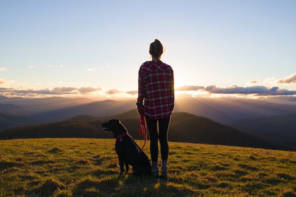
Everything above is work. Max Patch is not — a 1.6-mile loop across a grassy bald with almost no elevation gain worth mentioning, which is precisely why it draws the volume of visitors that has forced rangers to close it to camping entirely and post rules about drones and group size that nobody in 1970 would have imagined necessary. A bald, if you haven’t encountered the term, is a mountaintop that stays clear of trees for reasons ecologists still debate — grazing history, soil, fire, some combination nobody has fully pinned down — and Max Patch is the platonic example, 360 degrees of open sky at 4,629 feet with the Smokies visible on a clear day. It has become, unfortunately, a preferred spot for engagement photos and sunset parties, which tells you something about how a landscape this unguarded gets loved to the edge of ruin. Go on a weekday morning instead. The bald is at its best when it’s just wind moving through grass and nobody performing anything for anybody.
Bear Mountain, New York
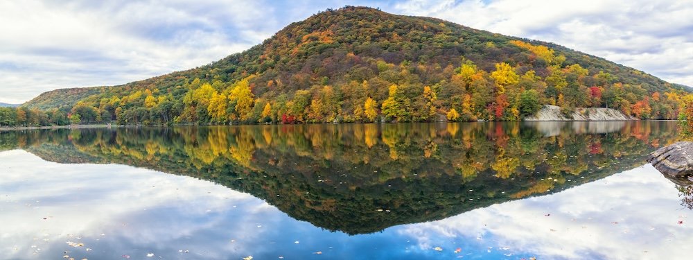
The AT’s approach to Bear Mountain, topped by the stone lookout of Perkins Memorial Tower, is a reminder that the trail doesn’t require wilderness to be worth walking — this stretch runs through a state park an hour from Manhattan, past a zoo, alongside picnicking families, and still delivers a genuine Hudson Highlands view stretching toward the city skyline on clear days. It’s a short, well-graded climb by AT standards, popular enough on weekends to feel more like a civic gathering than a hike. There’s a particular satisfaction in reaching a fire tower shared with Georgia’s black bears and Maine’s moose, then descending to a parking lot with a snack bar.
Franconia Ridge, New Hampshire
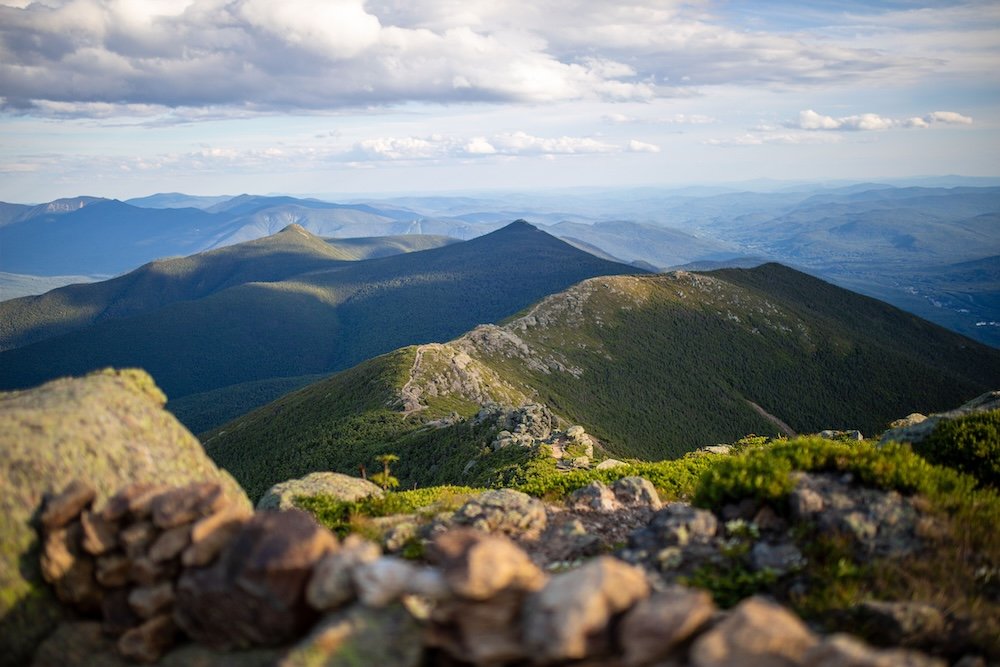
Save this one for a genuinely clear day, because Franconia Ridge above treeline is where the Appalachian Trail stops being forgiving. The loop over Mount Lafayette (5,240 feet) and Mount Lincoln (5,089 feet), typically climbed via the Old Bridle Path and descended by Falling Waters Trail, gains roughly 3,600 feet across a route that alpine stewards have clocked at over 1,200 hikers on a busy weekend day, a volume the fragile above-treeline vegetation was never built to absorb, which is why you’ll find scree borders laid decades ago by Laura and Guy Waterman, the couple who essentially invented backcountry Leave No Trace ethics on this exact ridge. The exposed walk between the two summits, with the Presidential Range visible to the east and nothing but sky on either side of a narrow trail, is the closest the day-hiking version of the AT comes to explaining why anyone would want to walk the whole thing. Weather here turns without asking permission. Check the Mount Washington Observatory forecast, not the one for the valley floor, and turn back if the ridge disappears into cloud.
The boots are probably still hanging in that rhododendron tree at Neel Gap. New ones get added most seasons. Nobody takes them down.