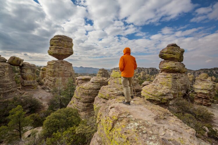
Chiricahua National Monument spans over 12,000 acres and is home to a vast array of towering rock spires, precariously balanced boulders, and intricate hoodoos. Located approximately 120 miles southeast of Tucson, Arizona, near the town of Willcox, the monument sits at the intersection of the Chiricahua Mountains, Sulphur Springs Valley, and the expansive Sonoran Desert.
The unique geological formations that define the landscape are the result of a violent volcanic eruption that occurred around 27 million years ago, known as the Turkey Creek Caldera eruption, that spewed ash and pumice over 1,200 square miles, creating a thick layer of volcanic debris. Over millions of years, the volcanic material compacted and solidified into a rock called rhyolite. Exposure to the elements, particularly the erosive forces of water and wind, gradually sculpted the rhyolite into otherworldly shapes. The process of weathering and erosion continues to shape the landscape.
The Chiricahua Apaches, led by the famous warrior Geronimo, once called this region home and used the rugged terrain as a natural fortress against their enemies. In the late 19th century, the area attracted settlers, miners, and ranchers, drawn by the promise of mineral wealth and the opportunity to establish a new life in the untamed wilderness.
In 1924, President Calvin Coolidge recognized the unique geological and historical significance of the Chiricahua Mountains and declared 4,400 acres as a national monument. Over the years, the monument has expanded to its current size, ensuring the protection of this extraordinary landscape for generations to come. However, a designation as a National Park requires an act of Congress and, to date, Congress has failed to act.
The most striking feature of Chiricahua National Monument is its array of rock formations and “hoodoos.” Hoodoos are tall, thin spires of rock that protrude from the bottom of an arid drainage basin or badland. These formations are created by the differential erosion of alternating soft and hard rock layers, resulting in a wide variety of shapes and sizes.
Visitors to the monument can explore a network of trails that wind through the towering spires and balanced rocks. Some of the most popular formations include the “Big Balanced Rock,” a massive boulder precariously perched atop a narrow pedestal, and the “Punch and Judy,” a pair of hoodoos that resemble the famous puppet characters.
In addition, Chiricahua National Monument also preserves a piece of the region’s pioneer history through the Faraway Ranch. The ranch was established in the late 19th century by Swedish immigrants Neil and Emma Erickson, who initially worked as caretakers for a local mining company. Over time, the Ericksons acquired land and began raising cattle, eventually transforming their homestead into a successful guest ranch.
Today, visitors can explore the Faraway Ranch and learn about the challenges and triumphs of frontier life in the American Southwest. The ranch features a collection of historic buildings, including the original Erickson family home, a barn, and several guest cabins. Guided tours and interpretive programs offer insights into the daily lives of the Erickson family and the guests who visited the ranch during its heyday.
The monument also offers camping facilities, including a 25-site campground among the rock spires. In addition to hiking and camping, visitors can also enjoy wildlife watching, birding, and scenic drives through the monument. The Bonita Canyon Scenic Drive offers a leisurely 8-mile journey through the heart of the monument.

